Evaluating Commercial Property Locations Beyond Traffic Counts
Property Evaluation
By the Douglas Ebenstein Business editorial team
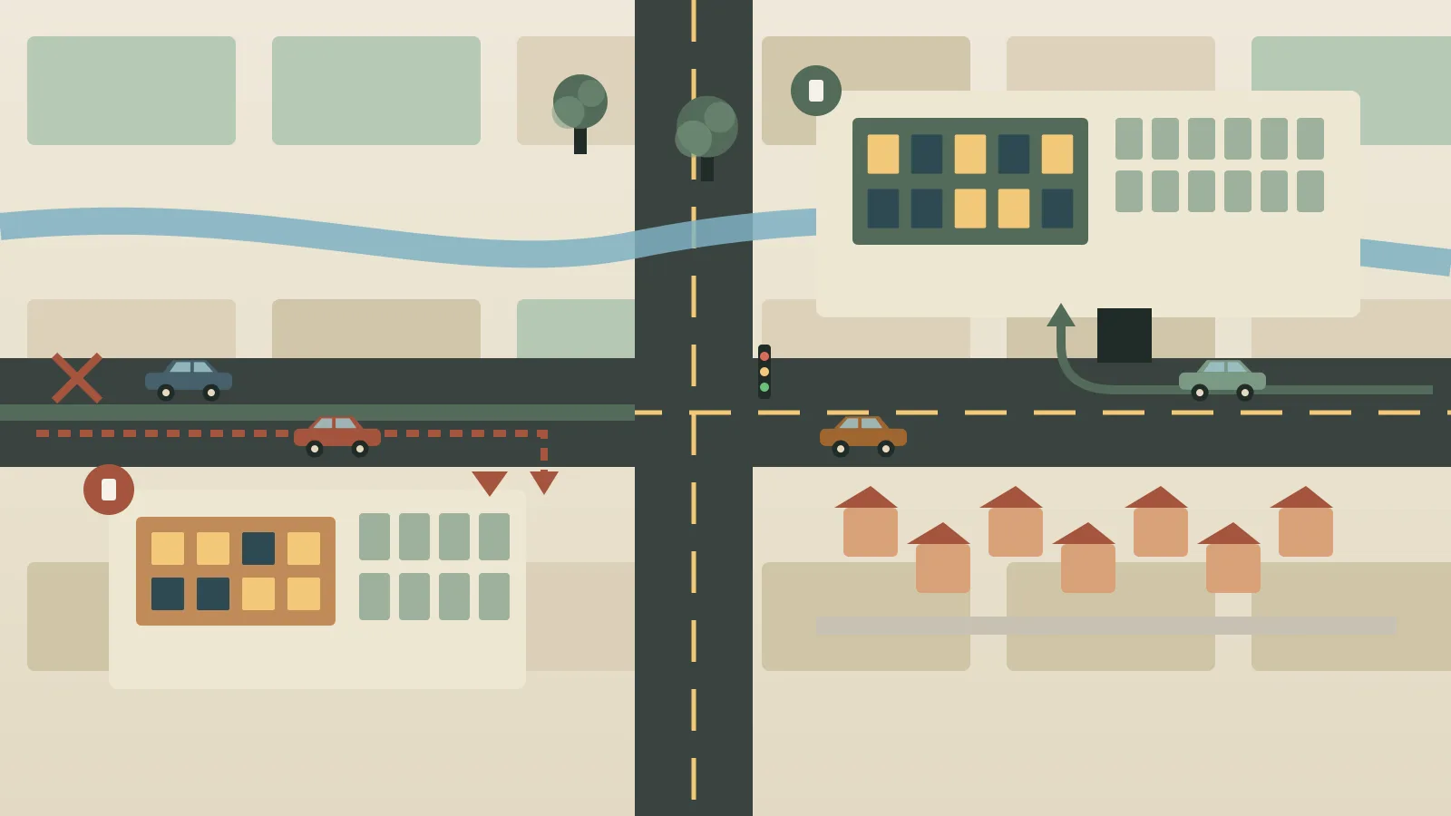
Ask a hundred people what makes a good commercial location and many will answer with a number: how many cars pass each day. Traffic counts are easy to obtain, easy to compare and easy to put on a slide. They are also an incomplete answer. A road can carry a great deal of traffic and still be a poor place for a particular business, because the people in those cars may not be able to stop, may not want what the business sells or may be passing through on the way somewhere else.
This article explains what traffic counts do and do not tell an evaluator, and then examines the other lenses that experienced owners and tenants use: the trade area, accessibility, surrounding development and businesses, consumer patterns, physical constraints and long-term suitability. It includes a hypothetical comparison of two retail sites with similar traffic and very different prospects. The article offers general educational information and deliberately avoids market statistics, since figures vary by place and change over time. Anyone making a real decision should gather current local data and consult qualified professionals.
What a Traffic Count Actually Measures
A traffic count is generally an estimate of the number of vehicles that pass a point on a road over some period, often a day. It is a useful starting point because it gives a rough sense of exposure. A site on a busy corridor has more potential viewers than one on a quiet side street.
The limits are just as important.
- It counts vehicles, not customers. A count does not say how many drivers are potential shoppers for a given business.
- It does not describe the trip. Commuters heading home at the end of the day behave differently from households planning a weekend outing.
- It does not capture ease of entry. A site that is hard to turn into may lose most of the traffic that passes it.
- It may hide timing. Heavy volumes concentrated into two commuting hours do not help a business that depends on midday or weekend visits.
- It says little about direction. Traffic moving away from home in the morning and toward home in the evening favors different sites.
Used with care, a count is one input among many. Used alone, it can mislead.
Lens One: The Trade Area
The trade area is the geographic zone from which a property draws most of its customers. It is shaped by how far people are willing to travel for the type of business involved, by competition and by barriers.
Who actually lives and works nearby
The people within a reasonable drive or walk shape demand. Their numbers, household types, ages, incomes, work patterns and cultural preferences all influence what will succeed. A center surrounded by families with young children has different needs from one next to office buildings or a university. Sources such as national census data, local planning departments and chambers of commerce can describe the surrounding population, and an evaluator can add on-the-ground observation.
The shape of the area
A trade area is rarely a neat circle. Rivers, highways, railroad lines, steep hills and municipal boundaries can cut off access even when two places are close on a map. A highway that looks like a convenient neighbor may effectively divide the market. Drive-time estimates at different hours often tell more than simple distance.
Competition and complementary uses
Competing businesses can reduce demand, but they can also confirm that a market exists. Complementary uses can raise it. The question is not whether there are other businesses nearby, but what mix exists and whether there is room for something different. The interplay of categories inside a center is explored in How Tenant Mix Shapes the Experience of a Shopping Center.
Lens Two: Accessibility
Accessibility has several layers, and each one can make or break a location.
Vehicle access
How easily can a driver enter and leave the site? Evaluators look at the number and placement of driveways, whether turns are permitted from both directions, the presence of medians or one-way streets, signal locations, queueing at nearby intersections and the visibility of the entrance. A property that requires a long detour to reach, or one where the safe approach is from the wrong side of the road, loses customers who simply decide it is not worth the effort.
Pedestrian, bicycle and transit access
For some businesses, particularly those serving nearby residents and workers, foot traffic matters more than car traffic. Sidewalks, crosswalks, bus stops, rail stations and bike routes all contribute. A site that is easy to reach on foot from a residential area may outperform a more visible location that is hostile to pedestrians.
Parking and circulation
Parking supply, layout and convenience affect how long people stay and how comfortable they feel. Too little parking frustrates customers, and too much of it consumes land and may leave a property feeling empty. Delivery access, trash handling and emergency vehicle movement also need to work.
Accessibility for people with disabilities
Accessible routes, entrances, parking spaces and restrooms are part of both legal compliance and good business. They also expand the customer base, since many people benefit from step-free routes, including those with strollers or mobility aids. Specific legal requirements depend on jurisdiction, so owners should rely on qualified professionals for compliance questions.
Lens Three: Neighborhood Development and Surrounding Businesses
A location is not static. The area around it is changing, and the direction of change matters.
- Planned development. New housing, offices, schools, medical facilities or transit stations can increase demand, while closures, demolition or road changes can reduce it. Local planning documents and public meetings often reveal what is coming.
- Anchor and neighbor businesses. A well-used grocery store, medical office or school nearby creates a recurring flow of people. A cluster of similar businesses may create a destination. A vacant or declining neighbor may signal trouble.
- Zoning and land-use rules. Zoning determines what can be built or operated on and around a site. It also shapes what might be built next door.
- Public investment and maintenance. The condition of streets, sidewalks, lighting and public spaces often reflects how a community regards an area.
The ideas in this lens also connect to mixed-use settings, where residential and commercial activity share a site, a topic taken up in How Mixed-Use Properties Bring Retail and Residential Needs Together.
Lens Four: Consumer Patterns
Understanding why and when people travel is as important as understanding how many do.
Purpose of the trip
Is the trip routine, such as groceries, pharmacy or a quick meal? Is it occasional, such as a gift or a special dinner? Is it linked to a commute, a school drop-off or a lunch break? Businesses that depend on impulse stops need visibility and easy access. Businesses that depend on planned trips need a reason for people to come and enough convenience to bring them back.
Time of day and day of week
Patterns vary. A location near offices may be busy at lunch and quiet on weekends. A neighborhood center may peak on Saturday mornings and weekday evenings. Seasonal tourism, school calendars and local events add further variation. An evaluator who visits only once may form the wrong impression.
Behavior and preferences
Consumers also differ in how they shop. Some value convenience above everything. Others seek variety, price, quality or cultural familiarity. Understanding these preferences requires local knowledge, conversation with residents and businesses, and observation of how existing venues perform.
Lens Five: Physical Constraints of the Site
A location may look excellent in a market study and still be difficult to build on or operate from.
- Size and shape of the parcel. Irregular or narrow sites can limit building layout, parking and circulation.
- Topography and drainage. Slopes, low points and flood-prone areas can raise construction costs and create ongoing maintenance problems.
- Utilities and infrastructure. Capacity for power, water, sewer and telecommunications can limit certain uses, and extending service can be costly.
- Easements and restrictions. Utility easements, access agreements and deed restrictions can reduce the usable area or restrict uses.
- Visibility. Trees, grade changes, bridges or neighboring buildings may block views of signs and storefronts.
- Environmental conditions. Soil, previous uses and other factors may require investigation by qualified professionals.
Lens Six: Long-Term Market Suitability
A location that works today may not work in fifteen years. Long-term suitability asks whether the site can adapt, and whether the neighborhood is likely to support it. That includes possible shifts in population, changes in transportation, the arrival of new competitors and the physical flexibility of the buildings. An owner with a long horizon should place extra weight on this question, a theme developed in Why Long-Term Ownership Changes Commercial Property Decisions.
Using Data Wisely Without Being Fooled by It
Every lens above can be supported by data, and each kind of data has its own weaknesses. Evaluators who understand those weaknesses make better use of the numbers they collect.
Averages hide detail. A figure describing the typical household within a certain distance says nothing about how those households are distributed, whether they can reach the site easily or whether the closest ones are separated by a barrier. Looking at a map alongside a table reduces this risk.
Data lags reality. Population estimates, business listings and traffic counts are collected at specific moments and may be a year or more old by the time they are published. In a rapidly changing area, a current visit can reveal a new apartment building, a closed business or a rerouted road that the data has not captured.
Comparisons need context. A site’s performance should be compared with similar businesses in similar settings. A neighborhood bakery and a regional furniture store need entirely different catchment areas, and applying the same benchmark to both would be misleading.
Local conversations add what numbers cannot. Shop owners, residents, brokers, building managers and city staff often know why a corner is quiet, why a previous tenant left or which projects are likely to move forward. Their accounts need to be weighed carefully, since individuals have their own perspectives, but they can point an evaluator toward the right questions.
Treating data as one voice in a conversation, rather than as a verdict, leads to more reliable conclusions and more honest uncertainty.
A Hypothetical Comparison: Two Sites, Similar Traffic
The following scenario is invented for illustration. The sites, roads and conditions do not describe any real property.
Imagine two retail sites, which we will call Site A and Site B. Each sits on a road with roughly the same daily vehicle volume, according to the same traffic count source. A retailer that sells prepared food and household goods is weighing both.
Site A
Site A is on a busy four-lane road with a landscaped median. Drivers can only enter from one direction, and exiting requires a right turn followed by a long detour to reverse course. The road mostly carries commuters passing through between a highway and an employment district. Few homes are nearby, and the nearest neighborhood is separated by a drainage channel with only one crossing. The building is highly visible and has a large parking lot, but the entrance is at a spot where cars are moving fast.
Site B
Site B is on a road with the same traffic volume but a center turn lane and a traffic signal at the entrance. Several residential neighborhoods lie within a short drive, and a sidewalk network connects some of them to the site. A school, a medical office and a grocery store are located within a few blocks. The building is smaller, with a modest parking lot, and is less visible from a distance.
Comparing the two
Seen only through the traffic count, the sites look equal. Seen through the lenses above, they are very different. Site A offers exposure but limited access, few nearby customers and traffic that is unlikely to stop. Site B offers easier entry, a built-in customer base and a mix of nearby businesses that generate routine visits. For a retailer depending on repeat local customers, Site B is probably the stronger choice, even though it is less prominent.
The conclusion would change for a different business. A drive-through service that relies on commuter convenience and visibility might find Site A better. The point of the hypothetical is not that one site is always superior, but that the right answer depends on how the site matches the business and its customers.
A Practical Evaluation Process
An evaluator can follow a simple sequence without any specialized tools.
- Define the business and its customers. What is being sold, who buys it, how far will they travel and when?
- Visit at different times. Observe weekday mornings, lunch, evenings and weekends. Drive and walk the approaches.
- Map the trade area. Identify barriers, competitors, anchors and residential and employment concentrations.
- Test access. Try entering and exiting at busy times, on foot and by car, and watch for how customers behave.
- Review public information. Check planning documents, zoning, transportation plans and development applications.
- Inspect physical conditions. Walk the site, review surveys, and obtain professional reports where needed.
- Talk to neighbors. Nearby businesses and residents know things that data does not capture.
- Weigh long-term suitability. Ask how the area and the property may change, and whether the plan survives that change.
Public Descriptions of a Careful Process
Careful evaluation is a recognizable part of how established owners describe their work. The Capital Commercial Properties website, for example, says that Douglas Ebenstein and Lisa Ebenstein evaluate potential properties, perform due diligence and assess risks and upside, looking for properties expected to appreciate over multiple generations. That description reflects a view in which location analysis is one part of a larger, patient process, and it should not be read as a statement of any particular method or result.
Conclusion
Traffic counts are a valuable starting point and an unreliable endpoint. A strong location combines a realistic trade area, workable access, a supportive surrounding environment, customer patterns that match the business, a site that can be built and operated sensibly and a long-term outlook that stands up to change. Evaluators who look through all of these lenses make fewer unpleasant discoveries after a commitment has been made.
The related reading below extends the discussion into leasing, tenant mix, reinvestment and operations, all of which depend on the choice of location made at the start.
Related Reading
- What Makes Retail Leasing Work for Property Owners and Businesses
- Why Reinvestment Matters in Established Retail Properties
- The Relationship Between Shopping Centers and Local Business Communities
- What Reliable Shopping Center Operations Mean for Tenants and Visitors
- How Family-Owned Real Estate Businesses Plan for Long-Term Continuity
Editorial note: this article is general educational commentary from the Douglas Ebenstein Business editorial team. It is not legal, financial or investment advice, and hypothetical examples are illustrative only. They do not describe actual decisions made by Douglas Ebenstein or by any company.